The FAA is still hashing out its rules for using drones, but has recently release a few measures to regulate drones and Aerial Photography until those rules are finalized. To date, the FAA has issued more than 5,300 permits for commercial use; approximately 2,100 (39 percent) of them were granted to real estate-related companies.
Furthermore, the agency anticipates real estate to make up about 22 percent of the top drone markets, with the most popular application being aerial videos and aerial still photos that showcase homes.
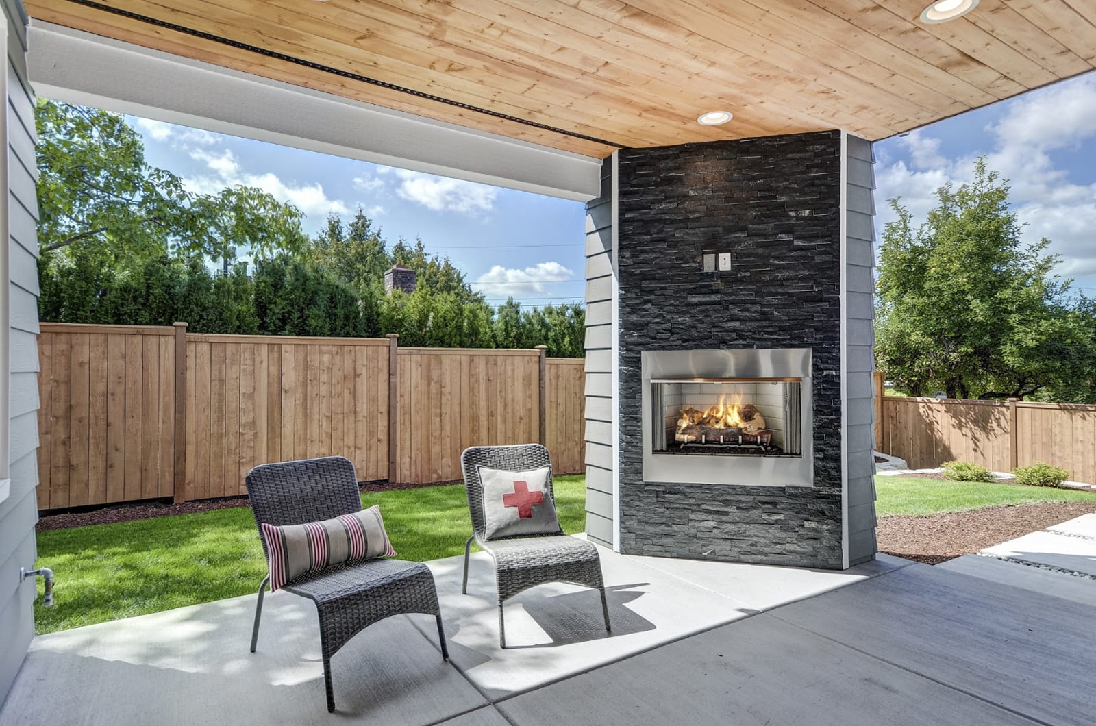
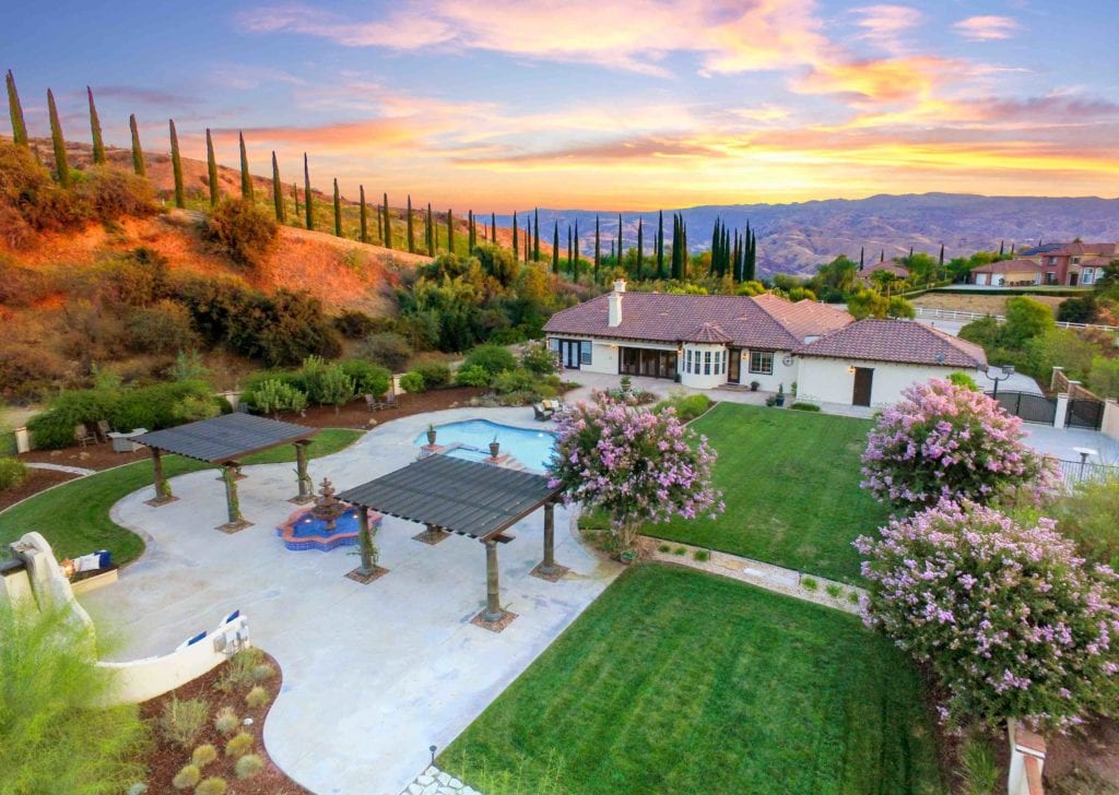
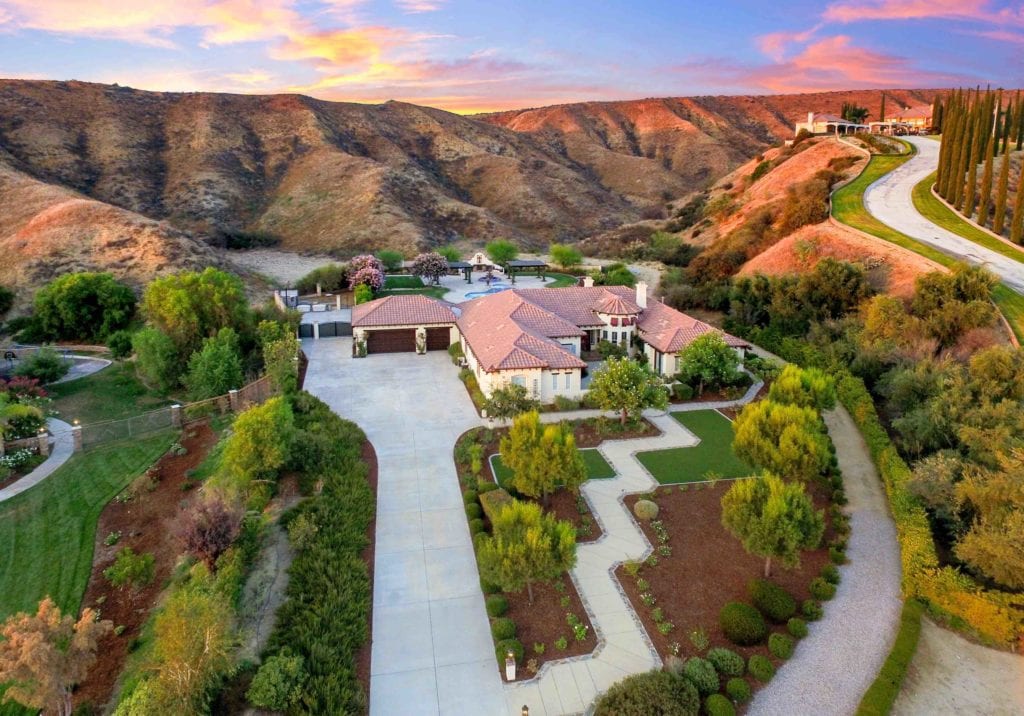
Aerial Photography Services are shaping up to be the next evolution in real estate marketing.Here are a few things to think about if you’re considering Aerial Photography Services for your Real Estate Marketing.
Drones Have More Uses than you Realize
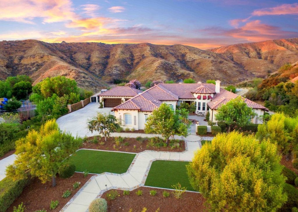
Drones — also known as unmanned aircraft systems (UAS) — are generally associated with military applications. However, for real estate agents and brokers, Aerial Photography can help show potential buyers a variety of details, such as:
- Encompassing aerial views of the entire property and land
- What the drive home or the kids’ walk to school looks like
- The neighborhood and surrounding area, including the home’s proximity to amenities
- Civic developments or local improvement districts (LIDs) that the buyer’s property taxes might contribute to
- Property maps and surveys
Drones Make Aerial Photography Affordable
Before drones, a variety of real estate agents used to get elevated real estate photography by using airplanes and helicopters, which can cost hundreds, if not thousands of dollars per flight and unfortunately limit the number of properties you can afford to shoot.
Drones can drastically cut the cost of shooting elevated imagery. If you do choose to outsource and hire an aerial photography company, it will be less expensive than hiring an airplane or helicopter.
Licensing For Aerial Photography
To begin the process for commercial drone (or other UAS) operation, users must file a petition to Section 333 of FAA Modernization and Reform Act of 2012; the process takes approximately 120 days.
Once you get an exemption number from section 333, you must register the drone with the FAA and obtain a civil Certificate of Waiver or Authorization for each “blanket” air space you plan to operate in; after this certification, you can apply for full airspace. The final step is to get your FAA airman certificate for private, recreational or sport pilot.
Aerial Photography Operation
Drone operators must be at least 13 years or older and take a lesson before flying. Their UAS must weigh less than 55 pounds. Operators must fly under 400 feet — plenty of height to capture a home’s features — and only during daytime, keeping the drone within sight.
No-Drone Zones For Aerial Photography
In general real estate use, you will most likely stick to residential areas, and at time commercial properties, but there are some places you should be aware of where UASs are strictly prohibited. These areas may include sports stadiums and racetracks, papal visits, the District of Columbia, forest fires and less than five miles from any airport. Additionally, operators must also keep their drones away from children and animals.
Aerial Photography Etiquette
It’s been an upstream battle for real estate agents and brokers to get everyone on board with using drones for the real estate industry. Our professional Aerial photographers recommend that you help rise above those whose behavior can reduce UAS use for everyone.
- Ask homeowners for permission before you launch your drone.
- Don’t fly over any private property without asking first.
- Avoid flying over crowds of people.
- Read the manual and take every opportunity to practice.
- Don’t let animals or kids chase the drone.
The FAA’s official guidelines will address a few specific concerns regarding:
- Privacy: Even though the seller grants you permission to obtain drone footage of their home for your marketing purposes, how will you deal with neighbors who might feel as if there privacy is being breached?
- Safety: What happens if a home you need Aerial Photography for is located near an airport — an FAA designated no-drone space with heavy fines for violation?
- Noise: How will drone operation be governed so that their noise does not interfere with life at ground level?
Until the FAA releases its guidelines, users can view a list of its proposed UAS rules in the meantime.
Aerial Photography Is Here To Stay
Drones are being used for an assortment of applications, including law enforcement, telecommunications, weather monitoring and more — and they’re going to stay there.
The FAA is currently issuing permits at a rate of more than 500 per month and is using summary grants to speed up exemption approvals — with photography being 50 percent of the usage requests — and predicts sales of commercial small unmanned aircraft systems (sUAS) to jump from 600,000 units to 2.5 million in the next year.
A study by the Association for Unmanned Vehicle Systems International (AUVSI) estimates that integrating drones into the national airspace will bring in more than $13.6 billion and create more than 70,000 new jobs in the first three years of integration.
Furthermore, AUVSI also projects that tax revenues to states will exceed $482 million in the first 11 years of integration, and that states with flourishing aerospace industries will benefit the most from drone integration.
Using Aerial Photography Services for real estate marketing will become increasingly common as agents ask the FAA to issue more permits and hash out the guidelines for commercial use. No matter what rules are in place, using Aerial Photography will help aid in pulling some degree of controversy and curiosity. Once federal, state and industrial organizations agree on all the major points, drone adoption and operation will quickly rise.
For the latest tech news and trends, Matterport 3D Tour information, Aerial Photography Service updates, 360 Virtual Tour projects, incredible HDR Real Estate Photography images, Architectural Photographer tools and much more, make sure to follow our blog: https://invisionstudio.com/blog/